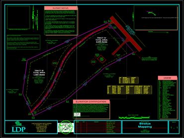
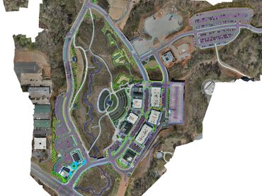
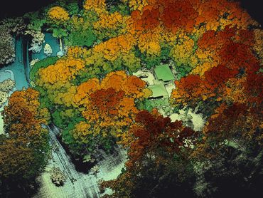
Stratus Mapping
  • Home
  • Lidar
  • Surveys
  • Consulting
  • Land Planning
  • Our Projects
  • About
  • More
    • Home
    • Lidar
    • Surveys
    • Consulting
    • Land Planning
    • Our Projects
    • About
Stratus Mapping
Get a Free Quote
  • Home
  • Lidar
  • Surveys
  • Consulting
  • Land Planning
  • Our Projects
  • About
Get a Free Quote

Stratus Mapping

Stratus Mapping Stratus Mapping Stratus Mapping

Quick & accurate site surveying, volume calculations - topographic precision mapping solutions for your property needs.


Stratus Mapping

Offerings

With LiDAR drone technology, Stratus Mapping can help you manage your job site from above.  From Volume Calculations to Hazard Identification, the use of LiDAR can help in a variety of ways including progress monitoring and quality control, time and cost savings, rapid data acquisitions and more.  At Stratus Mapping we do Boundary Surveys, Property Line Staking, Site Plan Surveys, Special Use Permits, Topographical Surveys, ALTA Land Title Surveys, Foundation Surveys, As-Built Surveys, Land Planning - Commercial and Residential Site Plans, Lot Consolidation, Subdividing, Demolition Plan Survey, House Corner Staking, Construction Staking, Box-Check Survey, as well as Due Diligence when Buying Real Estate, Parks & Recreation Planning, Hydrology Surveys, Grading Plan for Permit, Erosion & Sediment Control Plans, SWPPP's & SWMPs,  NPDES Wastewater & Stormwater Permits, plus much more.


We are a dedicated team of professionals, and we promise prompt service and value for any project our services are needed.

Contact Us

Contact Us

STRATUSMAPPING.ORG

Carving a path to precision mapping with photogrammetry and lidar!

Stratus Mapping is a Division of Land Development Professionals

BRUCE@LDPOFGA.COM

678 794 0191

Hours

Open today

09:00 am – 05:00 pm

Drop us a line!

Attach Files
Attachments (0)

This site is protected by reCAPTCHA and the Google Privacy Policy and Terms of Service apply.

Social

Subscribe

Sign up to hear from us.

Copyright © 2025 Stratus Mapping - All Rights Reserved.

Powered by

  • Lidar
  • Surveys
  • Consulting
  • Land Planning
  • Our Projects

This website uses cookies.

We use cookies to analyze website traffic and optimize your website experience. By accepting our use of cookies, your data will be aggregated with all other user data.

Accept