Lidar Drone Technology
Lidar
LiDAR is a type of remote sensing method that uses light in the form of a pulsed laser to measure ranges to the Earth. When put on a drone, it can create high-resolution digital surfaces, terrain and elevation models. LiDAR is an active system that uses ultraviolet, near-infrared light to image objects requiring no external light for effective mapping. For example, when monitoring an interstate pileup at night, a LiDAR-equipped drone can easily be deployed, making a single pass over the site.
How it works
- Drones equipped with LiDAR sensors (Light Detection and Ranging) emit laser pulses to measure distances to objects.
- These laser pulses create a point cloud, a 3D representation of the area, with each point representing a measured distance.
- Software processes the point cloud to generate 3D models, allowing for precise volume calculations.
Advantages of using drones for volumetric calculations:
- Accuracy: LiDAR technology offers high accuracy in volume measurements, with vertical accuracy reaching up to 10-15 centimeters.
- Efficiency: Drone-based surveys are faster and more cost-effective than traditional methods, such as manual surveying.
- Safety: Drone surveys can be conducted safely, even in hazardous areas, reducing risks to human surveyors.
- Real-time data: Drones can provide near real-time data, allowing for quick decision-making and project management.
Applications of LiDAR Drones:
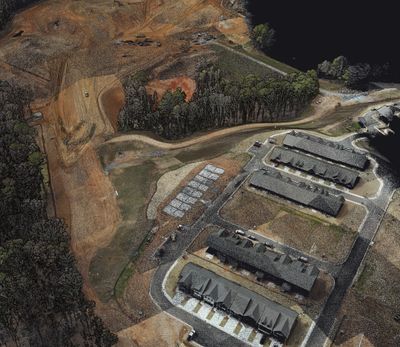
- Surveying and Mapping: Creating detailed 3D maps, digital terrain models (DTMs), and digital surface models (DSMs) for urban planning, land development, and natural resource management.
- Construction: Site surveys, progress tracking, quality control, and safety inspections, providing real-time data on site conditions and helping to optimize layouts and reduce excavation requirements.
- Environmental Monitoring: Assessing coastal erosion, riverbank stability, habitat mapping, and tracking ecosystem changes.
- Forestry: Measuring tree height, canopy density, and biomass, as well as detecting invasive species and assessing wildfire risk.
- Agriculture: Monitoring crop health, soil analysis, irrigation management, and precision planting and harvesting.
- Infrastructure Inspection: Inspecting bridges, roads, dams, power lines, and pipelines to identify defects, assess structural integrity, and plan maintenance and repairs.
- Archaeology: Discovering hidden archaeological features, assessing historical sites, and creating digital replicas of cultural heritage assets.
- Disaster Management: Rapidly assessing damage in disaster-affected areas to aid in emergency response, search and rescue, and recovery planning.
- Mining: Assessing topography, monitoring stockpile volumes, identifying potential hazards, and supporting mineral exploration.
Key Considerations:
- Sensor Accuracy: The accuracy of the LiDAR sensor and the quality of the data captured are crucial for reliable volume calculations.
- Data Processing: Proper data processing and analysis are essential to ensure accurate and meaningful results.
- Software: Specialized software is needed to process LiDAR data, generate 3D models, and perform volumetric calculations
Key Concepts of LiDAR
Active Sensor: LiDAR is an active sensor, meaning it emits its own light source (lasers) to measure distances.
- Point Cloud Data: LiDAR data is typically represented as a point cloud, a collection of points in 3D space that define the shape and structure of the scanned environment.
- Accuracy and Precision: LiDAR offers high accuracy and precision in distance measurements, enabling the creation of detailed 3D models.
- Penetration: LiDAR can penetrate through vegetation and other obstructions, allowing for the mapping of ground surfaces that are difficult to access with traditional methods.
- Applications: LiDAR drones are used in various applications, including topographic mapping, forestry, urban planning, agriculture, and infrastructure inspection.
How LiDAR Works:
A LiDAR sensor emits laser pulses towards the ground.
The sensor measures the time it takes for each laser pulse to return after reflecting off an object.
The time it takes for the pulse to return is used to calculate the distance to the object.
By measuring distances to numerous points, a detailed 3D model of the environment is created.
Advantages over Traditional Methods:
- Faster Data Acquisition: LiDAR drones can cover large areas quickly and efficiently compared to traditional ground-based surveys.
- Reduced Costs: LiDAR on drones can be more cost-effective than manned aircraft surveys.
- Accessibility: LiDAR drones can access areas that are difficult or impossible to reach with traditional surveying methods.
- High Accuracy: LiDAR provides highly accurate data, especially in challenging environments.
- Penetration of Vegetation: LiDAR can penetrate vegetation, allowing for accurate mapping of the ground surface underneath.
